 |
||||||||
|
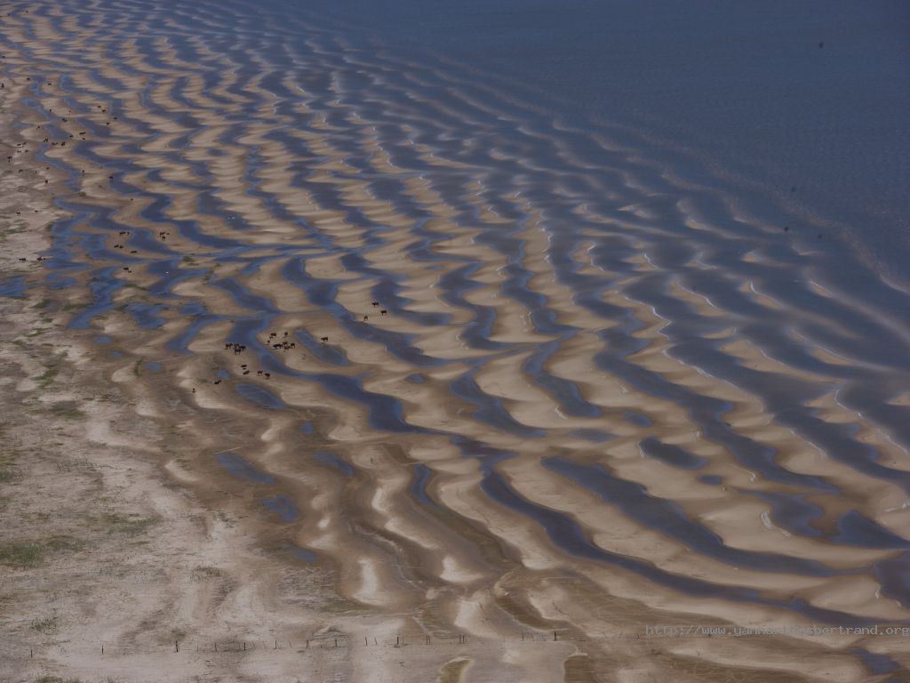
A herd of cows, Laguna Merín near Punta Magro, Rocha, Oriental Republic of Uruguay (34°07’S, 53°44’W). The Laguna Merín basin is located on South America’s Atlantic coast, in temperate or sub-tropical zones. It occupies about 6 million hectares (14 million acres), the western half of which covers 18 % of Uruguay, whereas the other half is in Brazil. The landscape offers a relief of soft undulations, large plains, prairies and swamps. The climate is sub-tropical, with a rainfall ranging from 1.200 to 1.500 milimeters a year. This is one of the richest ecosystems in the country, as regards to the fauna and flora diversity. Laguna Merín is a huge fresh water lake of 2.500 sq. Km with an essential ecological value. The survival of millions of migratory birds depends on the preservation of these swamps, one of 15 main migration zones on the planet. The biodiversity of these prairies is rich, and for a long time it was only disrupted by livestock grazing. Still, in the past twenty years, environmental damage has taken a new turn with the development of rice culture. Over a century, half of the planet’s wetlands have been dried up. Foto y texto original (photo and original text): Yann Arthus-Bertrand |
||||||||
|
||||||||
